
This Saturday afternoon, 17 October, the Dayboro & District Rural Fire Brigade is running a free Bushfire Ready community information session at Mount Pleasant Hall. Ninety minutes, no cost, and by the end of it you will know your risk, understand the fire danger ratings, and have a plan for the one decision that matters most: leave early, or stay and defend.
We want to give you the honest picture of why this one is worth your Saturday. The short version: our own rain gauge jsut recorded the driest July to September in its twenty year record, the national fire services have flagged south-east Queensland for a tougher season, and fire doesn't care whether your place is a cattle property on Mt Mee Road or a brick house in a cul-de-sac. The photos further down show exactly that.
Bushfire Ready? Community Information Session
When: Saturday 17 October 2026, 1:30–3:00pm
Where: Mount Pleasant Hall, 352 Mt Pleasant Rd, Mount Pleasant
Who: Presented by the Dayboro & District Rural Fire Brigade (Rural Fire Service Queensland)
Cost: Free, no booking needed
On the agenda: know your risk, fire danger ratings, leave early or stay and defend, tuning into warnings, your emergency kit, preparing around your home, Neighbourhood Safer Places, and what happens after a fire. Details on the event page.
What our own gauge says about this season
Every bushfire season forecast starts with one question: how dry is the land going into it? We don't have to guess. The weather station here has measured every drop since December 2005, and the winter just gone was the driest in that whole record.
| Month | 2026 rainfall | Station average (20 years) |
|---|---|---|
| July | 7.8mm | 60.6mm |
| August | 25.2mm | 51.5mm |
| September | 4.2mm | 56.1mm |
| July–September total | 37.2mm | 168.2mm |
That's 22% of a normal winter and early spring. September gave us 4.2mm all month. October normally brings close to 139mm here, and to 13 October we have 4.1mm. The grass that grew on the summer rain has cured, the soil underneath it is dry a long way down, and that combination is fuel.
The bigger picture agrees with the gauge. The AFAC Seasonal Bushfire Outlook for Spring 2026, released in August, puts south-east Queensland in the increased fire risk zone, on the back of January to July rainfall in the lowest 10% of historical records for parts of southern Queensland and low soil moisture across the region. The Bureau declared an El Niño in June, and the Indian Ocean Dipole is positive as well. We wrote up what that pairing has meant historically in our spring bushfire risk analysis back in August; the one-line summary is that the last time both lined up like this was the lead-in to the 2019-20 season.
Our Dayboro Model and the Inigo Jones cycle work point the same direction for the months ahead: October leaning toward the driest third of years, roughly 89% of normal rain expected, and the season outlook sitting at 93% of normal through November. Temperatures near average, which sounds comforting until you remember near average for a Dayboro November includes days in the high 30s. The next 30 days of model output actually show 23 dry days out of 31 and at least one day reaching about 37°C.
One more thing from the long range charts, and it belongs in a bushfire post: the same Inigo Jones cycle reading that leans dry for spring swings the other way for summer. The four analogue seasons average out at 151% of normal rain for December to February, and every single one of them came in wet. Our flood risk rating for the new year sits at moderate, with January to April the peak window. We will be upfront, the traditional reading is close to a coin toss on its measured track record, so take it as a watch rather than a warning. But a burnt, bare catchment sheds water fast when the storms do arrive, which is exactly why "after the fire" is the last topic on Saturday's agenda. Dry season first, and possibly a very wet one right behind it.
And yes, there is decent rain on the cards for this very Saturday. If it falls, be glad, and go to the session anyway. One wet afternoon doesn't rewet a dry winter. It grows more grass, and grass cures.
This region has form
Moreton Bay's own bushfire hazard management strategy is blunt about it: a century of records shows real bushfire potential across this region, and the high consequence fires line up strongly with drought years. Dry year, bad fires. Indeed, that's the pattern, and this is a dry year.
You don't need to look far back either. The early-season fires of 2019 destroyed around 17 homes in Queensland while the smoke hung over our valley for weeks, and that season followed the same script: record low rainfall in the lead-up, then early heat. Dayboro sits in a bowl with the D'Aguilar Range on one side and Mt Mee above us, with bush and cured paddocks running right up to town. Hazard reduction burns happen around here for a reason.
I have seen how fast it goes. Here is the proof
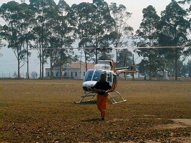
A bit of personal history, kept short because this post is not about me. Before Dayboro, I served on fire grounds in the Sydney fires of December 2001, and later around the Canberra and Victorian fires. The photos in this post are mine, from the Black Christmas fires that burned across New South Wales from Christmas Eve 2001 into January 2002. More than 750,000 hectares and over a hundred homes went in those two weeks.
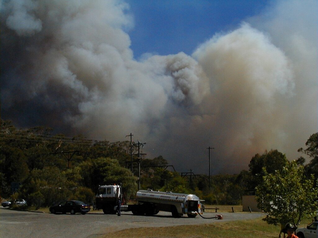
These two photos are the reason I keep telling people to come to sessions like Saturday's. On the picture below left, a staging area filling with tankers, smoke building behind the treeline. Below right is the same area about five minutes later.
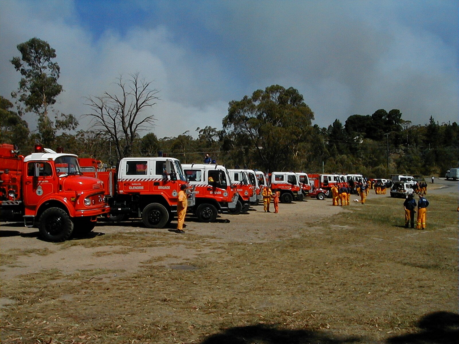
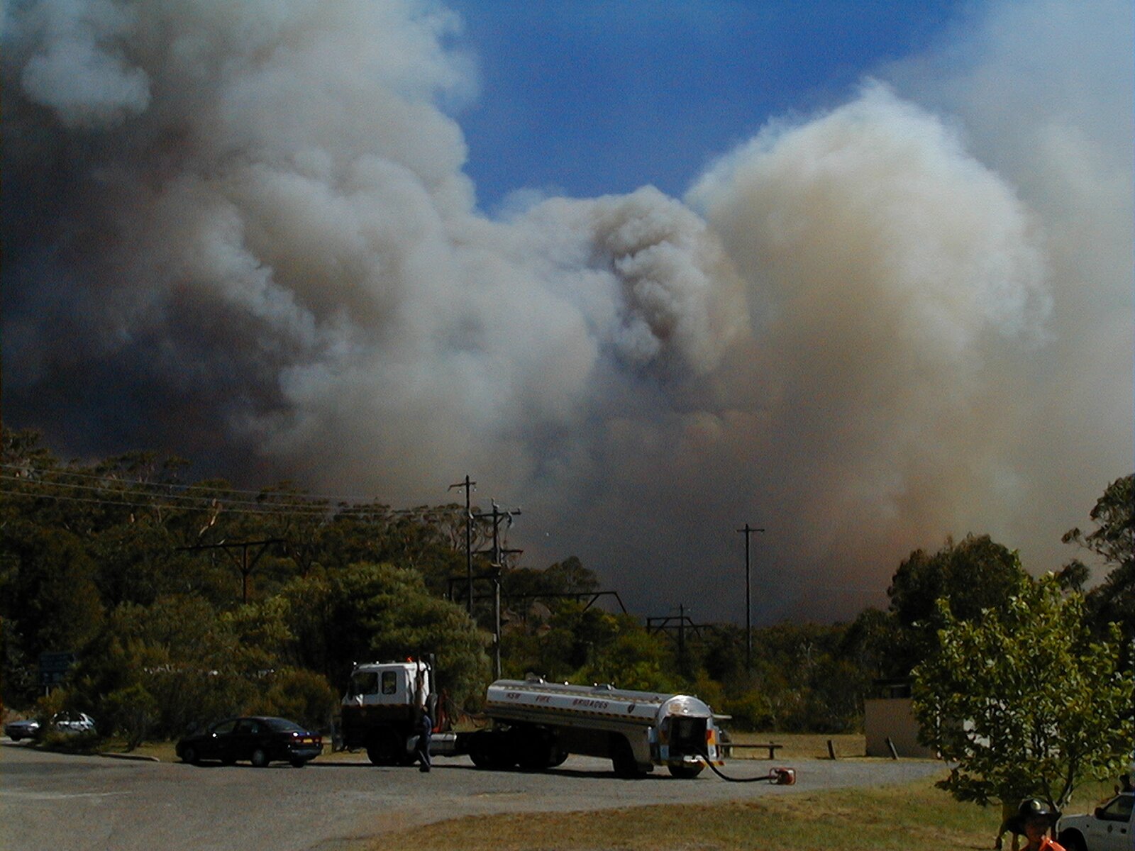
Five minutes. That is the window a running fire gives you, and it's why "we will see how it looks and then decide" is not a plan. A plan is made at the kitchen table in October, not in the driveway with the sky going black. The session on Saturday walks you through exactly that decision, leave early or stay and defend, and what each choice actually requires of you.
It is not only rural properties
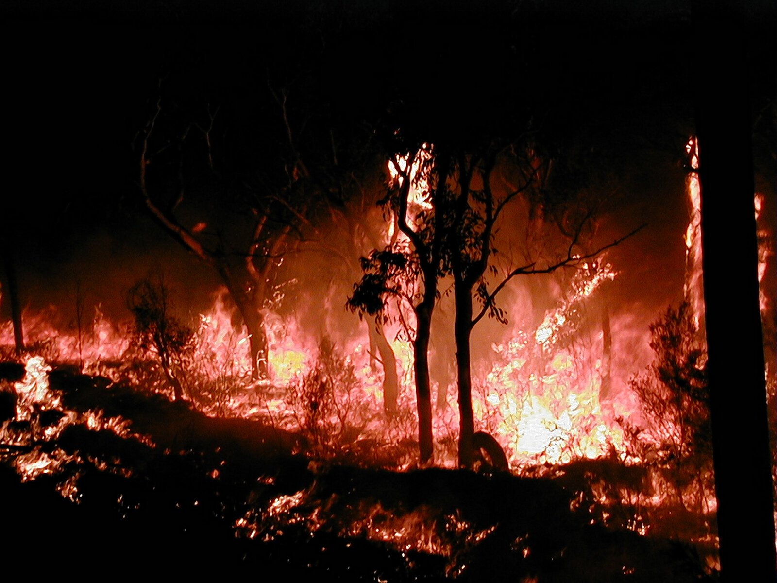
Here is the part I most want the town blocks to hear. On Christmas Day 2001, embers from the fires burning in the Blue Mountains came down on Glenmore Park, an ordinary new suburb past Penrith. Lawns, fences, colorbond, the lot. Spot fires lit up in the vegetation around the estate, and houses burned, kilometres from the fire front, in streets that look a great deal like the newer parts of Dayboro.
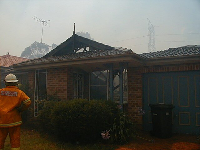
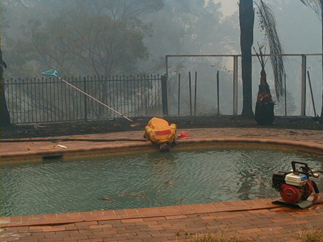
I keep going back to that second photo. Mains pressure drops when a whole street opens the taps at once, and tankers can't be everywhere. The house in that picture was saved with a petrol pump drafting from the family pool. I saw that work with my own eyes. Water you own, a pump that doesn't need electricity, and somebody who knew in advance how to use it. That's preparation, and it's topic five and six on Saturday's agenda.
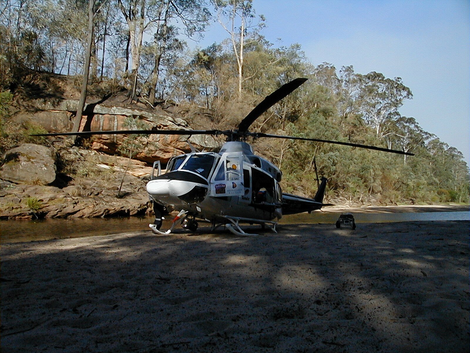
Some of the work on those fire grounds was the kind nobody takes photos of, and I will leave it at that. The people it happened to were not careless people. Most of them were simply late: late deciding, late leaving, late finding out the road out was already cut. Everything the brigade will tell you on Saturday is aimed at never being late.
What to do this week
The paddocks around town are actually as dry as we have seen them in years, so a few things are worth doing before Saturday rather than after:
- Come to the session. Saturday 17 October, 1:30–3:00pm, Mount Pleasant Hall. Bring the household, including the teenagers who may one day be home alone when a warning lands.
- Clear the easy fuel. Gutters, long grass against the house, woodpiles on the veranda, doormats and outdoor cushions on a bad day. Embers find these first.
- Check your water. If you have a pool, dam or tank, think through how you would move that water without mains power. If the answer is a pump, test it now, not in December.
- Download and set up the Queensland fire warning channels. Don't wait on a knock at the door; in 2001 there often was none. The brigade will show you exactly which warnings to tune into on Saturday.
- Have the kitchen table conversation. Leave early, or stay and defend. If you can't answer what your trigger is and where you would go, that is the gap the session fills.
The brigade members running this are volunteers, our neighbours, and they would rather spend ninety minutes with you in a hall in October than meet you on your driveway in December. See you there.
Rainfall figures are from our own weather station record (December 2005 to now). Seasonal outlook from the AFAC Spring 2026 Seasonal Bushfire Outlook, the Bureau of Meteorology climate drivers, and the Dayboro Model with Inigo Jones cycle analysis. Photos: Dayboro team archive, NSW, December 2001.
The Dayboro team
Get Dayboro weather delivered to your inbox every morning: forecasts, garden tips, and local updates. Subscribe free →