Dayboro.au | Flood Risk Explainer (Oct 2025 – Jan 2026)

Flood risks

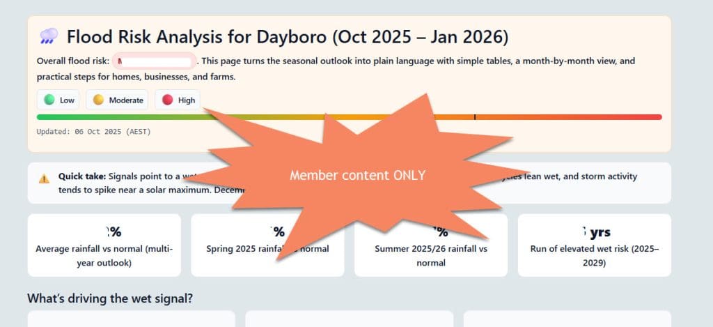
🌧️ Flood Risk Analysis for Dayboro (Oct 2025 – Jan 2026)

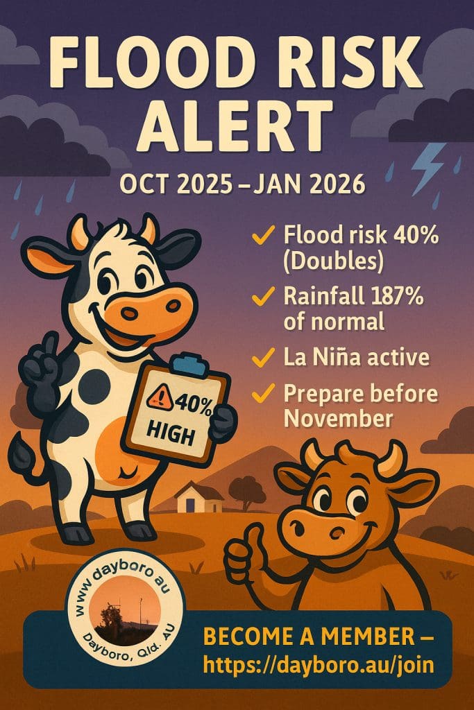
Overall flood risk: MODERATE to HIGH. This page turns the seasonal outlook into plain language with simple tables, a month-by-month view, and practical steps for homes, businesses, and farms.

🟢 Low 🟡 Moderate 🔴 High

Updated: 06 Oct 2025 (AEST)

⚠️
Quick take: Signals point to a wet spring that rolls into a very wet summer. La Niña is active, local seasonal cycles lean wet, and storm activity tends to spike near a solar maximum. December and January carry the highest flood risk.
132%
Average rainfall vs normal (multi-year outlook)
156%
Spring 2025 rainfall vs normal
187%
Summer 2025/26 rainfall vs normal
5 yrs
Run of elevated wet risk (2025–2029)

What’s driving the wet signal?

La Niña 🌊

La Niña often brings more rain to eastern Australia. With it active, Dayboro usually sees more frequent showers, longer wet spells, and higher chances of storm run-off into creeks.

Seasonal cycles 📈

The Inigo Jones framework points to a 35-year “wet phase” (often called the Bruckner cycle), lined up with other timing signals like a Jupiter opposition. These cycles tilt the odds toward above-average rain.

SAM & solar activity ☀️

A positive SAM in spring/summer and a solar peak both tend to lift storminess over SEQ. That can mean more intense downpours when systems pass through.

Inigo Jones 5-Year Outlook (simple view)

Headline: “Wetter than average conditions ahead with elevated flood risk.”

Period Rain vs Normal Flood Risk Notes
Spring 2025 (Sep–Nov) 156% Moderate Wet phase timing + early storms
Summer 2025/26 (Dec–Feb) 187% High La Niña peak; severe storms more likely
2025–2029 (multi-year) Avg 132% Elevated Run of wetter-than-normal years

Agriculture flags: “Make sure drainage is in place” and “Secure gear and sheds against storm winds.”

Live climate drivers (plain-English)

La Niña: Active

Typically means more rain for the east. For local creeks, that lifts flood odds, especially when systems stall or repeat.

Indian Ocean Dipole (IOD): Neutral

Little push either way right now. The Pacific signal is doing most of the work.

Southern Annular Mode (SAM): Positive

In spring and summer, a positive phase often lines up with more rain over southeast Queensland.

Month-by-month risk (Oct → Jan)

Month Rain vs Normal Flood Risk What to expect locally
October 2025 (now) ~156% 🟡 Moderate Storms kick in; short-burst downpours can lift creek levels quickly.
November 2025 Above average 🟡/🔴 Moderate → High Peak storm season gets close; saturated ground raises run-off.
December 2025 ~187% (near double) 🔴 High La Niña peak; repeated systems possible; flash flooding risk rises.
January 2026 Well above average 🔴 High Wet season in full swing; creeks and grounds already loaded.

Odds of flooding (Oct–Jan)

Level Chance (Oct–Jan) Typical local impacts
Minor 70–80% Low-lying crossings wet, paddocks soggy, small creek rises.
Moderate 50–60% Rural access issues, paddock fencing under water, stock movement needed.
Major 20–30% Road closures and isolation possible; consider high-ground plans.

Percentages reflect combined signals from seasonal cycles and current climate drivers. Actual outcomes depend on how systems track and repeat over our catchments.

What to do at home and work

Before November

  • Clear gutters, downpipes, driveway grates, and drain lines.
  • Tie down or move loose items; walk the yard for wind debris.
  • Review your policy and make sure your address details are right.
  • Pick two exit routes in case your usual road is cut.

December–January

  • Watch creek levels during long rain bands and after midnight storms.
  • Keep a simple kit: torches, batteries, first-aid, phone power bank, pet food.
  • Follow severe weather updates and local road alerts.
  • Use temporary barriers or sandbags if you are near waterways.

Farm & acreage notes

  • Field drainage: check fall, clean spoon drains, and open headlands.
  • Delay vulnerable plantings to February where possible.
  • Move pumps, fuel, seed, and spares above known high-water marks.
  • Plan stock access to high ground; mark fence heights at low points.

Tip: keep a paddock log of wet spots and overflow points; it helps with quick fixes after each event.

How to read “% of normal”

“156% of normal” means the season could deliver around one-and-a-half times the usual rain total. For flooding, the pattern matters as much as the total. Several wet weeks in a row can load the ground, so even a mild system later can push creeks up fast.

Bottom line

🎯
Signals line up for a wet stretch from now into January. The biggest watch period is December and January. Stay creek-aware, keep drains clear, and have a simple plan for access if roads are cut.

These are outlooks, not guarantees. Weather shifts, storm paths wobble, and totals can jump with one slow-moving system. Use this page for planning and pair it with official warnings on the day.

More Posts

Daily Weather Essentials Email Report

Start Your Day Right with Daily Weather Essentials – Dayboro Weather Start Your Day with Complete Weather Confidence Introducing Daily Weather Essentials – Your comprehensive